
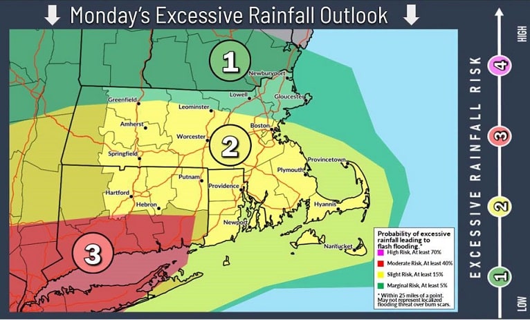

The National Weather Service has issued a Flood Watch for all of Rhode Island and portions of southeastern Massachusetts from 2 a.m. Monday through Tuesday afternoon, as multiple rounds of heavy rain could lead to flash flooding.
Forecasters expect periods of heavy rainfall beginning late Sunday night, with the most intense rain likely from Monday into Tuesday afternoon. Widespread rainfall totals of 1 to 3 inches are expected, but localized bands of torrential rain could produce 4 to 6 inches within six hours, increasing the risk of flash flooding in affected areas.
The Flood Watch includes all of Rhode Island, including Block Island, Bristol, Kent, Newport, Providence, and Washington counties, as well as southern Bristol County in Massachusetts.

Excessive rainfall may cause rivers, streams, and creeks to rise rapidly, while poor drainage and low-lying areas could experience flooding. Urban flash flooding is also possible, particularly where the heaviest rain develops.
While confidence remains low on the exact location of the heaviest rainfall, residents should be prepared for rapidly changing conditions and the potential for dangerous flooding.
Officials urge the public to:
- Monitor the latest weather forecasts and alerts.
- Be prepared to act if a Flash Flood Warning is issued.
- Never drive through flooded roadways. Turn around, don’t drown.
For flood safety information, visit www.weather.gov/safety/flood