



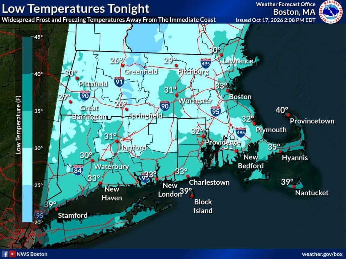
As autumn deepens across Massachusetts, residents are being warned to brace for a sharp drop in temperatures. Following a stretch of wet weather, the National Weather Service (NWS) Boston has issued clear signals that the season’s coldest air yet is settling into the region.
Areas situated away from the immediate coast are expected to plunge to freezing temperatures by Sunday morning. While coastal communities will stay slightly moderated, interior sections—particularly across western Massachusetts and isolated colder pockets in eastern Massachusetts—face a significant risk of a hard freeze accompanied by widespread frost. Gardeners and homeowners are encouraged to take necessary precautions to protect sensitive plants before heading to bed.
Local Forecast: Fall River & New Bedford Areas
If you live in the South Coast region around Fall River and New Bedford, expect a brisk and chilly weekend transitioning into crisp autumn weather.
- Tonight (Saturday, Oct. 17): Skies will clear out following earlier clouds, allowing temperatures to drop sharply. Expect overnight lows to dip near the low to mid-30s inland, while areas closer to the immediate coast and harbors hover a bit higher. Widespread frost is likely away from the water.
- Sunday (Oct. 18): Look for plenty of sunshine as dry high pressure takes control, though it will feel cool with daytime high temperatures topping out in the upper 50s.
- Sunday Night: Another cold night is ahead with clear skies. Lows will range from the mid-30s to near 40 closer to the South Coast waters.
- Monday (Oct. 19): Clouds will begin to increase from southeast to northwest as the day progresses, bringing a low chance of light showers later on. Highs will reach the upper 50s to around 60 degrees.
Tip: If you haven’t already, tonight is the ideal night to bundle up, check on your heating systems, and protect any remaining outdoor vegetation from the impending frost!